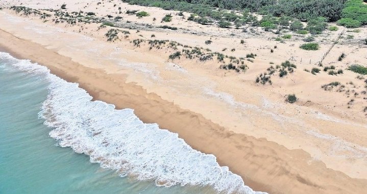
Coastal regions in monsoon climate zones experience constant change due to seasonal rainfall, strong winds, storm surges, powerful waves, and rising sea levels. Every year, thousands of kilometers of shoreline are reshaped as beaches erode, cliffs collapse, and coastal infrastructure becomes increasingly vulnerable. Roads, ports, fishing villages, tourism facilities, agricultural land, and residential communities often suffer severe damage because erosion develops gradually before accelerating during extreme weather events. Traditional coastal monitoring methods depend on periodic field surveys, which frequently fail to detect rapid environmental changes. Industry 4.0 provides an opportunity to transform coastal erosion monitoring into an intelligent, continuous, and predictive system.
Industry 4.0 combines artificial intelligence, the Internet of Things, cloud computing, digital twins, drones, robotics, satellite technology, and advanced data analytics to create connected industrial ecosystems. Applied to coastal management, these technologies provide continuous awareness of shoreline conditions and enable authorities to respond before erosion reaches dangerous levels.
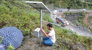
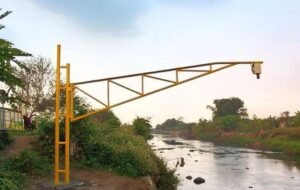
A smart coastal monitoring system begins with an extensive network of environmental sensors. Tide gauges, wave sensors, current meters, weather stations, rainfall monitors, groundwater sensors, and soil movement detectors are installed along vulnerable coastlines. These devices continuously measure environmental conditions that influence erosion. Information is transmitted in real time to centralized cloud platforms where artificial intelligence evaluates changing coastal risks.
Artificial intelligence processes large volumes of environmental data alongside historical shoreline records, seasonal monsoon patterns, satellite imagery, ocean current models, and climate forecasts. Machine learning algorithms identify patterns that indicate accelerated erosion, allowing coastal authorities to detect vulnerable locations weeks or even months before visible damage occurs.
Digital twin technology creates virtual models of entire coastal zones. Engineers simulate storm surges, tidal changes, heavy rainfall, river discharge, and wave action to understand how different environmental conditions may reshape beaches and coastlines. These simulations support long term planning while helping authorities evaluate the effectiveness of seawalls, breakwaters, mangrove restoration, artificial reefs, and beach nourishment projects.
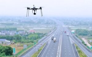
Drone technology significantly improves inspection capabilities. After storms, drones rapidly survey long stretches of coastline, collecting high resolution images of beaches, dunes, seawalls, cliffs, estuaries, and coastal roads. Artificial intelligence analyzes these images to identify shoreline retreat, damaged infrastructure, exposed foundations, sediment movement, and newly formed erosion channels.
Computer vision strengthens automated monitoring by comparing new aerial images with historical records. Small changes that may be overlooked during manual inspections become visible through artificial intelligence, allowing maintenance teams to respond before structural failures occur.
Satellite observation extends monitoring far beyond local inspection areas. Modern satellites continuously capture information about shoreline position, sediment transport, vegetation cover, river discharge, sea surface conditions, and land use changes. Combined with ground based sensor networks, satellite data creates a comprehensive understanding of coastal dynamics across entire regions.
Autonomous surface vehicles and underwater robots contribute additional information. These robotic systems inspect seabeds, coastal structures, harbor entrances, and underwater foundations without exposing divers to hazardous conditions. Sonar equipment maps sediment movement while underwater cameras identify structural damage beneath the water surface.
Cloud computing enables collaboration among environmental agencies, fisheries departments, disaster management authorities, port operators, meteorological services, research institutions, and local governments. All stakeholders access the same real time information through centralized dashboards, improving coordination during severe weather events and supporting evidence based policy decisions.
Predictive maintenance becomes possible for coastal infrastructure such as seawalls, piers, ports, bridges, and flood barriers. Sensors installed within concrete structures monitor vibration, corrosion, displacement, moisture penetration, and structural stress. Artificial intelligence estimates remaining service life and recommends maintenance before failures occur.
Industry 4.0 also supports ecosystem restoration. Artificial intelligence evaluates the effectiveness of mangrove forests, coral reefs, sand dunes, and coastal vegetation in reducing erosion. Restoration projects can be prioritized based on predicted environmental benefits, allowing governments to invest more efficiently in nature based coastal protection.
India has over seven thousand kilometers of coastline, much of which experiences strong southwest monsoon conditions. States including Kerala, Karnataka, Goa, Maharashtra, Odisha, Tamil Nadu, and West Bengal regularly face coastal erosion that threatens fishing communities, tourism infrastructure, ports, and transportation networks. Smart coastal monitoring systems would provide continuous information to support infrastructure planning and disaster preparedness.
Fishing communities would benefit significantly from improved coastal intelligence. Early identification of erosion risks protects fishing harbors, landing centers, storage facilities, and coastal roads that support local economies. Tourism destinations also gain resilience through better protection of beaches and waterfront infrastructure.
Climate change further increases the importance of intelligent coastal management. Rising sea levels, more intense cyclones, changing rainfall patterns, and stronger wave action increase erosion risks across many monsoon affected countries. Continuous environmental monitoring enables authorities to adapt more quickly to evolving coastal conditions.
Implementation requires investment in sensor networks, communication infrastructure, satellite data integration, artificial intelligence platforms, and skilled technical personnel. Data quality remains critical because predictive models depend on reliable environmental observations collected over long periods. Cybersecurity must also protect digital infrastructure supporting critical coastal management systems.
Community participation remains an essential element of successful implementation. Local fishermen, coastal residents, tourism operators, and environmental organizations possess valuable knowledge about changing shoreline conditions. Mobile applications allow communities to report erosion, damaged infrastructure, unusual wave activity, and flooding, providing additional information that strengthens artificial intelligence models.
Industry 4.0 is transforming coastal erosion monitoring from occasional observation into continuous environmental intelligence. By combining artificial intelligence, IoT sensors, drones, satellites, robotics, digital twins, and cloud computing, governments can predict erosion, protect critical infrastructure, strengthen coastal resilience, and support sustainable economic development. As climate pressures continue to reshape coastlines around the world, intelligent coastal monitoring will become an essential foundation for safeguarding communities, ecosystems, and industries that depend on stable and resilient shorelines.