Mountainous regions that experience seasonal monsoon rainfall face an increasing risk of landslides every year. Intense rainfall saturates the soil, weakens rock formations, increases groundwater pressure, and destabilises steep slopes. Roads, railway lines, villages, dams, power transmission lines, and communication infrastructure are often threatened by sudden landslides that occur with little warning. Traditional monitoring methods rely on periodic inspections and visual observations, making it difficult to detect small geological movements before a major slope failure occurs. Industry 4.0 technologies provide a new approach by creating intelligent monitoring systems capable of detecting instability long before disasters happen.
Industry 4.0 combines artificial intelligence, the Internet of Things, cloud computing, digital twins, drones, robotics, satellite technology, and predictive analytics into connected industrial systems. Applied to landslide monitoring, these technologies create continuous awareness of changing ground conditions and provide authorities with early warning capabilities.
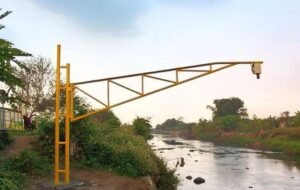
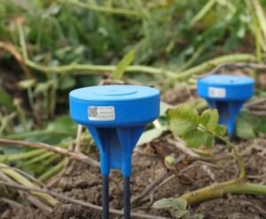
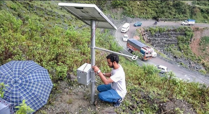
The foundation of a smart landslide monitoring system is a network of IoT sensors installed across vulnerable hillsides. Ground movement sensors measure tiny shifts in soil that are invisible to the human eye. Soil moisture sensors monitor how much water has entered the ground after rainfall. Rain gauges record precipitation intensity, while groundwater sensors measure pressure changes beneath the surface. Crack sensors installed on retaining walls and rock faces detect widening fractures that may indicate an approaching collapse.
All sensor data is transmitted continuously to cloud platforms where artificial intelligence analyses thousands of measurements every minute. Machine learning algorithms compare current conditions with historical landslide events, rainfall records, geological surveys, vegetation cover, and soil characteristics. When the combination of factors indicates increasing instability, automated alerts are sent to engineers and disaster management authorities.
Digital twin technology strengthens planning and decision making. Engineers create virtual models of hillsides that include terrain, vegetation, rock formations, drainage channels, roads, buildings, and underground water movement. Different rainfall scenarios can be simulated to understand how slopes may behave during prolonged monsoon conditions. Authorities can evaluate the effectiveness of retaining walls, drainage improvements, vegetation restoration, and slope reinforcement before construction begins.
Satellite technology provides large scale environmental monitoring. Modern satellites measure land movement with millimetre accuracy using radar imaging. Slow ground deformation occurring over weeks or months can be detected across extensive mountain ranges. This information complements ground based sensors by identifying new areas that require closer inspection.
Drone technology allows rapid inspection following heavy rainfall. High resolution cameras capture detailed images of hillsides, roads, bridges, railway corridors, and drainage systems. Artificial intelligence analyses these images to identify fresh cracks, fallen rocks, blocked drainage channels, exposed soil, and unstable vegetation. Survey work that previously required several days can often be completed within a few hours.
Computer vision improves the accuracy of inspections by automatically comparing new images with historical photographs. Small changes in terrain that might escape manual observation are highlighted by artificial intelligence, allowing engineers to prioritise high risk locations for field investigation.
Autonomous ground robots can inspect dangerous areas without placing personnel at risk. Equipped with cameras, laser scanners, environmental sensors, and ground penetrating radar, these robots travel across unstable terrain to collect geological information that supports engineering assessments.
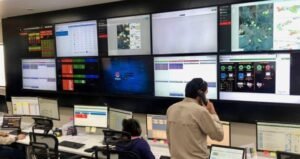
Cloud computing enables collaboration between geological departments, weather agencies, transport authorities, electricity utilities, emergency services, and local governments. All participating organisations access the same operational dashboard, improving coordination during severe weather events. Early warnings can be shared immediately with communities living near vulnerable slopes.
Edge computing increases operational reliability. Local processing units installed at monitoring stations continue analysing sensor data even if communication with cloud servers is temporarily interrupted during severe storms. Emergency alerts can still be issued without depending entirely on external communication networks.
Artificial intelligence also supports infrastructure planning. By analysing decades of rainfall, geological, and landslide data, machine learning models identify locations where future roads, railways, pipelines, and residential developments may face elevated geological risks. This helps governments avoid costly construction in unstable areas.
India has many regions that would benefit from intelligent landslide monitoring, including the Western Ghats, the Himalayas, the Nilgiris, the North Eastern states, and parts of Jammu and Kashmir. Every monsoon season brings landslides that interrupt transport, damage infrastructure, and endanger communities. Industry 4.0 systems would provide earlier warnings and improve disaster preparedness across these vulnerable regions.
Economic benefits are substantial. Early detection reduces repair costs for highways, railway networks, power infrastructure, and water supply systems. Businesses experience fewer supply chain disruptions, tourism recovers more quickly after storms, and emergency response operations become more efficient. Insurance companies may also use monitoring data to improve risk assessment models.
Environmental protection is another important advantage. Continuous monitoring helps identify areas where deforestation, quarrying, mining, or poor drainage practices increase landslide risks. Restoration projects involving native vegetation and improved water management can then be prioritised using scientific evidence generated by digital monitoring systems.
Implementation requires investment in communication infrastructure, sensors, cloud platforms, satellite data integration, and skilled technical personnel. Artificial intelligence systems depend on high quality geological and environmental data collected over long periods. Strong cybersecurity measures are also necessary because landslide monitoring increasingly becomes part of national critical infrastructure.
Community participation remains essential. Local residents often notice changes such as new ground cracks, tilting trees, unusual water seepage, or small rockfalls before instruments detect significant movement. Mobile reporting applications allow these observations to become part of the overall monitoring system, improving prediction accuracy and strengthening public engagement.
Industry 4.0 is transforming landslide detection from periodic inspection into continuous geological intelligence. By combining artificial intelligence, IoT sensors, drones, satellite monitoring, digital twins, robotics, and cloud computing, governments can predict slope failures earlier, protect critical infrastructure, reduce disaster losses, and strengthen community resilience. As climate change brings more intense rainfall to monsoon regions, intelligent landslide monitoring will become an essential pillar of safe and sustainable infrastructure development.