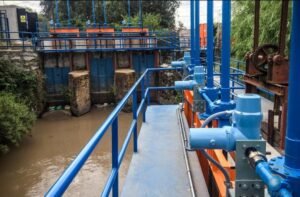
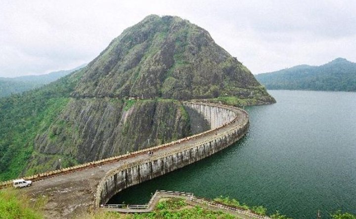
Water policy in India has traditionally been associated with infrastructure. Dams, canals, reservoirs, pipelines, irrigation projects and treatment plants dominate the public imagination of water management. These investments are important, but there is another infrastructure that is becoming equally important: information.
India needs to know its water before it decides how to develop it.
The basic principle should be simple: water projects should follow water intelligence, not substitute for it.
- The information problem
Water is constantly moving through rivers, reservoirs, aquifers, soils, farms, cities and ecosystems. Yet information about these systems is often distributed across institutions, jurisdictions and different measurement networks.
A government may know the level of a reservoir without knowing the condition of the aquifer beneath nearby villages. A city may know how much water it supplies without accurately knowing how much disappears through leakage. An irrigation department may know canal releases without having a complete picture of agricultural groundwater extraction.
This creates a governance problem.
Decisions are made using partial information about a connected system.
India has already built significant water-information infrastructure. The India-WRIS system, developed through collaboration involving the Central Water Commission and ISRO’s National Remote Sensing Centre, brings together large datasets on water resources, river basins and related natural resources.
The challenge now is to make such information central to everyday policy decisions.
- Measure the entire water cycle
Water governance should move beyond measuring individual projects.
A modern water information system should answer five basic questions for every major administrative and hydrological unit:
How much water enters the system?
How much is stored?
How much is consumed?
How much is lost?
How much is available for the future?
This requires combining rainfall, river flows, reservoir levels, groundwater levels, soil moisture, irrigation withdrawals, urban consumption, industrial demand, wastewater generation and ecological requirements.
The technology already exists to move substantially in this direction.
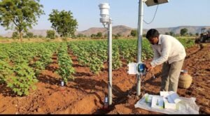
Automatic water-level recorders, weather stations, rain gauges and groundwater monitoring instruments are being deployed through India’s hydrological monitoring programmes. The National Hydrology Project was specifically designed to improve the extent, quality, timeliness and accessibility of water-resource information and to strengthen decision-making institutions.
The policy opportunity is to connect these systems.
- Groundwater needs an information revolution
Groundwater presents one of India’s greatest governance challenges because much of it remains physically invisible.
A borewell can extract water from an underground aquifer without the surrounding community immediately seeing the consequences. Thousands of individual extraction decisions can therefore accumulate into a major regional problem.
Groundwater governance should consequently be based on aquifers rather than simply on individual wells.
India has already undertaken extensive aquifer mapping and management planning. Government documentation describes the collection of geological, hydrogeological, water-level, recharge and extraction information as components of aquifer management.
The next step should be to turn this information into an operational public system.
A farmer should eventually be able to access information about the condition of the aquifer beneath the farm, seasonal recharge, extraction trends and recommended management practices.
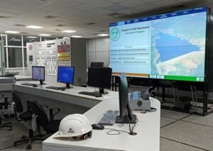
Local governments should have similar dashboards.
- Create district water accounts
Every district should maintain an annual water account.
This would function somewhat like an economic balance sheet.
The account could estimate rainfall contribution, surface-water availability, groundwater recharge, agricultural consumption, urban demand, industrial consumption, ecological requirements and major losses.
The purpose would not be to produce a perfect number. Water systems are too variable for absolute precision.
The purpose would be to establish a common evidence base.
A district facing declining groundwater should be able to identify the trend before wells begin failing at scale.
A city experiencing increasing demand should be able to identify the problem before constructing emergency infrastructure.
A region facing repeated floods should be able to examine whether storage, drainage and watershed management are appropriately configured.
- Put data into the hands of local governments
Water information becomes valuable when it changes decisions.
Panchayats and municipalities should therefore receive usable, simplified water dashboards rather than merely technical datasets.
A local government could see:
Current groundwater levels.
Rainfall compared with historical averages.
Reservoir and pond storage.
Estimated local consumption.
Water-quality indicators.
Wastewater generation.
Recharge structures.
Areas experiencing extraction pressure.
Such information could transform local planning.
Instead of discussing water scarcity only after a crisis occurs, local governments could identify emerging risks months or years earlier.
- Water projects should have an information requirement
Before approving a major water project, governments should ask what the available data says.
A new reservoir should be evaluated against existing storage.
A new irrigation project should be assessed against groundwater conditions and agricultural demand.
A new industrial development should demonstrate its water requirement and likely impact on local resources.
A new urban expansion should include a water balance.
This does not mean stopping infrastructure development.
It means improving the information used to justify it.
The question should change from “Can we build this?” to “What does the water system tell us about building this?”
- Create a national water data architecture
India needs stronger interoperability between water databases.
Different departments and states may collect useful information using different formats, standards and frequencies. A national architecture could establish common standards for measurement, data quality, geographic referencing and reporting.
The objective should not necessarily be to centralize every dataset.
Instead, India could create a federated system in which states and agencies retain operational control while agreed standards allow information to be connected.
The National Hydrology Project provides an important precedent: its components included monitoring systems, water-resource information systems, analytical decision-support platforms and institutional capacity building.
The next generation of water governance can build on that foundation.
- Use satellites and artificial intelligence carefully
Satellite technology can dramatically improve water governance.
Remote sensing can help monitor reservoirs, land use, vegetation, surface-water changes and other environmental indicators. Combined with ground measurements, these datasets can provide a much broader picture than either system alone.
Artificial intelligence can then assist with forecasting.
It could identify unusual groundwater trends, estimate demand, detect changes in reservoirs, forecast floods and droughts, and identify areas where water infrastructure may require intervention.
But AI should support governance rather than replace it.
The underlying measurements must remain transparent. Models should be independently evaluated. Public authorities should know the limitations of the systems they use.
Bad data processed by sophisticated algorithms remains bad information.
- Build early-warning governance
The greatest value of water data may be its ability to move policy from reaction to anticipation.
A good water-governance system should warn authorities before a crisis becomes visible.
Declining groundwater should trigger investigation.
Unusual rainfall should trigger reservoir-management reviews.
Rapid urban consumption growth should trigger demand-management measures.
Increasing pollution should trigger intervention.
The objective is not simply to create more dashboards. It is to create a chain from measurement to decision.
- From projects to intelligence
India does not have to choose between water infrastructure and water information.
It needs both.
But information should increasingly guide infrastructure investment.
India already possesses many of the building blocks: hydrological observation networks, groundwater monitoring, aquifer mapping, satellite capabilities, basin databases and water-information systems.
The next stage is institutional.
Water data should become a routine part of budgeting, infrastructure approval, agricultural planning, urban development and environmental regulation.
The central idea is straightforward.
Before India builds another water project, it should know the water system around it.
Before a city expands, it should know its water balance.
Before a district approves new water-intensive development, it should understand its groundwater and surface-water position.
Before governments respond to scarcity, they should have systems capable of detecting it early.
The future of water governance will depend not only on how much infrastructure India builds, but on how intelligently it measures and manages the resource that infrastructure is designed to control.
The next era of Indian water policy should therefore begin with a simple rule: measure first, model second, decide third, and build accordingly.